Day 3: Bishop, CA to Pahrump, NV (By way of Death Valley) - 296 miles

The day dawns sunny with puffy white clouds. Yay. They are still hugging the Sierras, but I feel it's gonna be good. Quick gas up and a wash and were off. Didn't see much of Bishop last night. Looks like a fun town. On Main Street..........

The south edge of town provided some nice views of the snow capped peaks.


We are in a north/south valley between the Sierras and the White Mountains. The White Mountains looking to the east.


Wasn't long before we had to stop again. The Sierras are finally cooperating........


Back on the road - view out the windshield - just, wow. What a glorious drive.

Forced to pull off again, near Independence.


Just south of Lone Pine is the turn off to Hwy 136, which leads to Death Valley. The Mt. Whitney Visitor center is here. Mt. Whitney is the highest point in the lower 48 states, topping out at 14,505 feet. Just a hundred miles to the east in Death Valley is the lowest point in the U.S. - Badwater Basin at 282 feet below sea level. Mt. Whitney is in the sunlight at the center point in the far distance in the photo below.

We put the Sierras in our rear view mirror and headed southeast. The landscape becomes noticeably more arid. The Sierras have wrung out all of the water from the air.


Hwy 136 merges with Hwy 190 coming west from Olancha and we'll soon start to climb into the mountains guarding the western edges of Death Valley.


A few miles further brings you to the Death Valley sign

The Father Crowley Overlook At 4,500 feet gives you a first glimpse of the valley below. The main part of the park is over the next mountain range in the distance.


The road then begins a several thousand foot descent to the valley floor and the next obstacle presents itself in a grand vista.

We begin a climb of several thousand feet again over 10 miles as we cross this range to get to Death Valley proper. Signs recommend turning your A/C off - probably makes sense in an older car when its 120F outside. We had a very pleasant 72F going outside. A/C remained on. The M850 kicked ass over Towne Pass - elevation 4,956 feet. It's really quite a fascinating ride up and over the pass. A long descent loses ALL the elevation again as you arrive into Stovepipe Wells (elev 10), a nice stopping point to stretch the legs.

Camping, a store, gas station and a couple of restaurants. A nice lunch and we are on our way again.

Looking back on Stovepipe from the east

Same road, facing the other way. Sea Level - Go figure

Salt Flat


Hwy 190 turns south toward Furnace Creek, eventually passing the Harmony Borax Works. Get your 20 mule team ready.


Next up is Furnace Creek - a large campground and RV spot, along with a hotel and golf course. Spent a spring break down here in a camper with a frat bro and his family, but we never really went anywhere or did any sightseeing. I'm seeing Death Valley for the first time. Furnace Creek Inn is up on a hill and is a fine Oasis of old school charm. Should've taken better pictures.


A little further up the road is Zabriskie Point. A short hike takes you to some nice, colorful views.


Backtracking a bit, we turn south on Badwater Road. The "real" Death Valley belongs down here. It's quite desolate. Shockingly desolate.


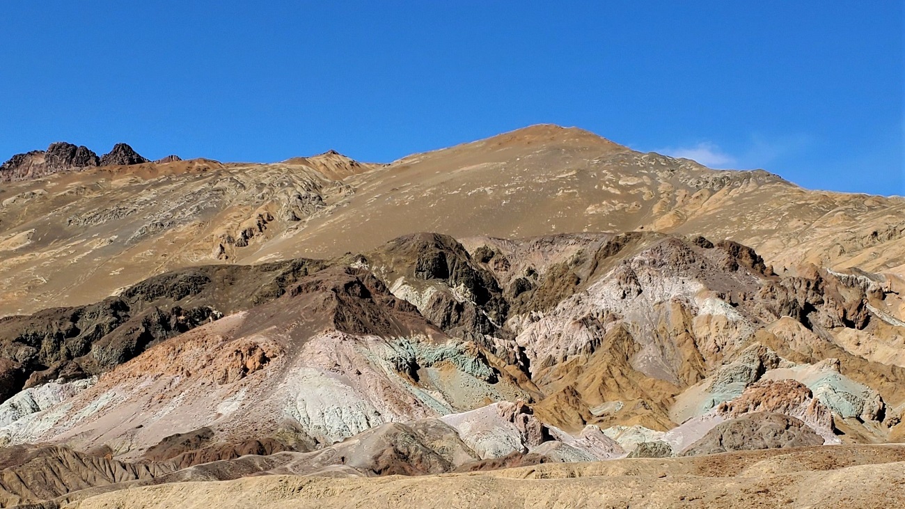
A short one- way loop turn-off will take you up near the mountains to Artist's Point with a colorful rock outcropping.


Back down in the Badwater Basin. Just gnarly. Shockingly gnarly.


The SottoZeros are quite marvelous in the desert. Giving me all the traction I need, whenever I've needed it. Haven't slid off the road once.

The Badwater Basin Viewpoint is about 18 miles south of Furnace Creek - with a large parking lot. 282 feet below Sea Level.

You can venture out onto the salt flats


They even went out of their way to show how far below Sea Level we are


Wouldn't want to be on foot trudging through here in 1849 on my way to look for gold.

At this point, most everyone just turns around. We chose to continue south another 28 miles to Ashford Junction and then headed east on Hwy 178 across the southern end of the park to Shoshone, another 28 miles. The road is eerily empty, along with everything else you can see. But, the scenery is spectacular. I'm still not a huge fan of deserts, but it's hauntingly beautiful.


Further on, the sky was just full of puffy clouds


Nearing Shoshone, an amazing vista opened up.


And just like that, you're outta the park. What a day - high of about 75F. Wouldn't want to be there in the summer when it hits 130F.

Another 30 minutes and we were in Pahrump, NV for the night. Can't imagine a better time to visit Death Valley. What a great day.